How to get inspired to find hotspots for fast & ultrafast charging
To find interesting potential search areas, you will need to explore the areas that are most promising and relevant to you. Here are some guidelines to help you find those.
- First, go to the Location Planning module
- Then, go to the map layers
(upper right corner) and select the following layers:
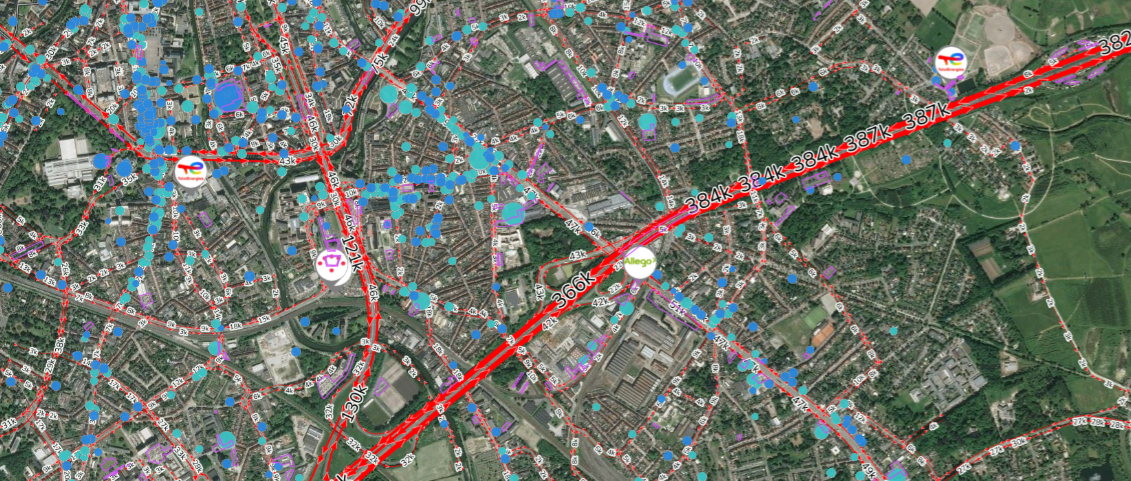
- Car passage: This layer shows the number of cars passing per week on each road segment.
- Local activity < 30min: This layer shows local activity that mainly attracts visitors with a duration less than .30 minutes as dots on the map. The size of the dots are in line with the number of visitors. This is potential that is mainly relevant for the charge&go segment.
- Local activity 30min - 2hours: This layer shows local activity that mainly attracts visitors with a duration between 30 minutes and 2 hours. The size of the dots are in line with the number of yearly visits. This is potential that is mainly relevant for the visit&charge segment.
- Locations: This layer shows the charging stations in the country as clickable markers on the map.
- Parking: This layer shows the majority of the current parking areas as purple areas on a map.
- Google Satellite: Shows a nice background layer.

By analyzing areas with many local activity with short visits (<30min) and high car passage (for ultrafast chargers) or, many local activity with short visits (30min - 2hours) (for fast chargers) you will be able to identify the most relevant areas to set up a new location. Beware that environments where a lot of competition is active, will be less interesting.
Once you have identified interesting test areas, you can start testing locations in as described here.
Note, consult all the details of the methodology in our technical report.

